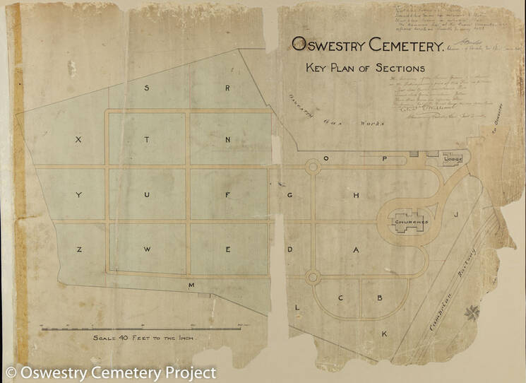
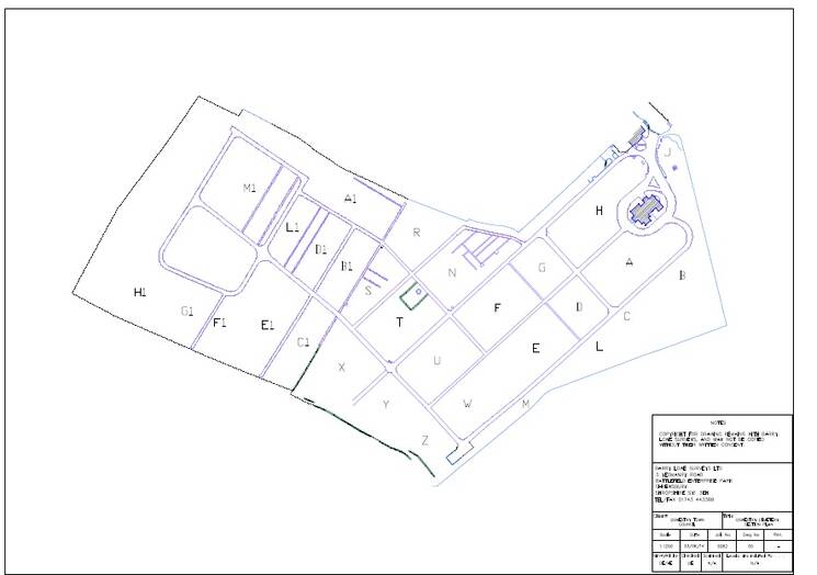
One of the aims of the Oswestry Cemetery Project was to map the graves using GPS technology. The creation of new electronic maps enabled Oswestry Town Council to conserve and archive the old maps (date c.1900) which they were still using. Barry Lowe Surveys Ltd were commissioned to map the graves.